Narrow Gauge Railroads
A Map to Follow
28/03/23 14:16
The beginning of this saga can be found here.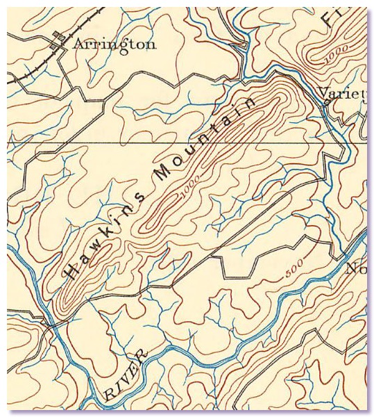
USGS Buckingham 1892
My request for such a map from the Historical Society got me a detail of an old USGS quad showing Arrington and the general area of the old soapstone mill, but nothing connecting the two. I was not sure what I was supposed to learn from it other than the obvious fact that there is a mountain separating the town from the mill. The Historical Society may have meant the map to assure me the narrow gauge railroad was plausible because Arrington and the soapstone mill were not very far apart, but that mountain had the opposite effect on me, making the narrow gauge in fact seem less plausible.
I mentioned all this to a good friend of mine who works for the utility company that serves the Arrington area. He said the electric company had detailed maps of the utility easements for that area going back to the beginning of electrical service. Sometime later he handed over a pile of photocopies of old maps.
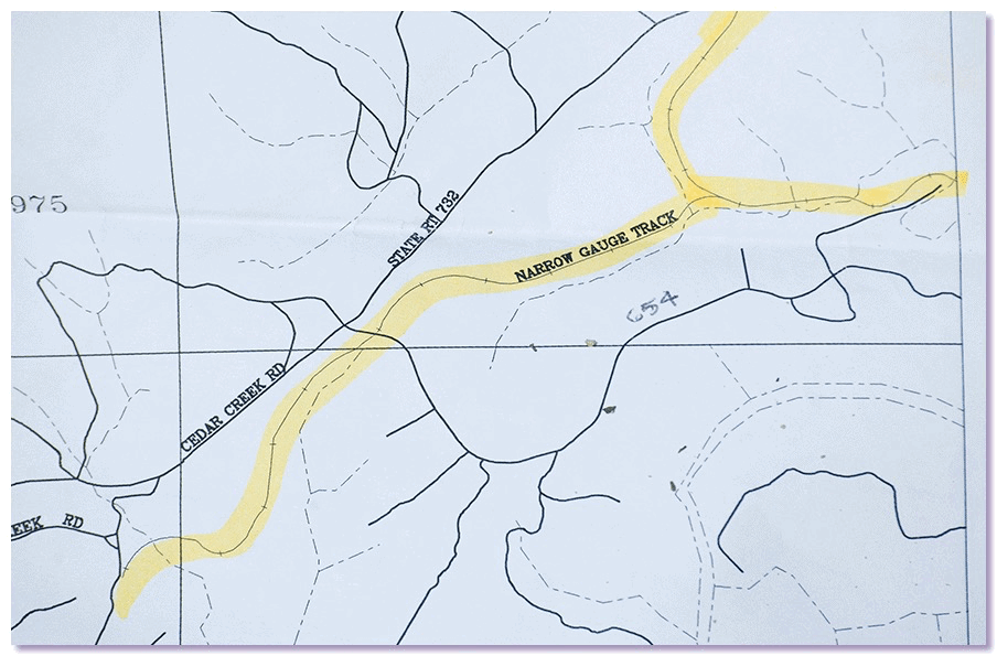
I worked my way down through the stack until I found one that showed a thin line marked ‘narrow gauge track’
Beyond old corporate records indicating Oliver Brothers had built a narrow gauge railroad, I wanted to see the old grade on a map.
USGS Buckingham 1892
My request for such a map from the Historical Society got me a detail of an old USGS quad showing Arrington and the general area of the old soapstone mill, but nothing connecting the two. I was not sure what I was supposed to learn from it other than the obvious fact that there is a mountain separating the town from the mill. The Historical Society may have meant the map to assure me the narrow gauge railroad was plausible because Arrington and the soapstone mill were not very far apart, but that mountain had the opposite effect on me, making the narrow gauge in fact seem less plausible.
I mentioned all this to a good friend of mine who works for the utility company that serves the Arrington area. He said the electric company had detailed maps of the utility easements for that area going back to the beginning of electrical service. Sometime later he handed over a pile of photocopies of old maps.
I worked my way down through the stack until I found one that showed a thin line marked ‘narrow gauge track’
More information, still no evidence
14/03/23 11:11
The beginning of this saga can be found here.
An inquiry to the Nelson County Historical Society asking whether there had actually been a narrow gauge soapstone railroad found its way to an attorney named Dick Whitehead who sent me copies of ancient DGMR reports on Phoenix Stone Company.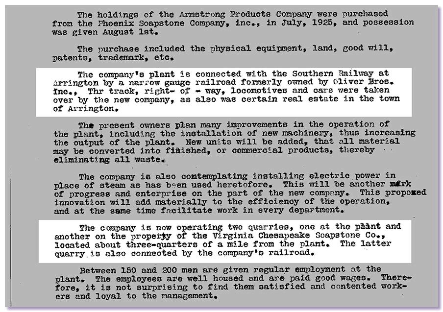
DGMR ECON FILE - STANDARD SOAPSTONE CORP ca1926
The Phoenix Stone report mentioned that the narrow gauge ran to Arrington. So I collected my maps, gassed up the truck and headed out to Arrington and again came up empty. I saw nothing there to suggest an abandoned railroad grade or transfer point.
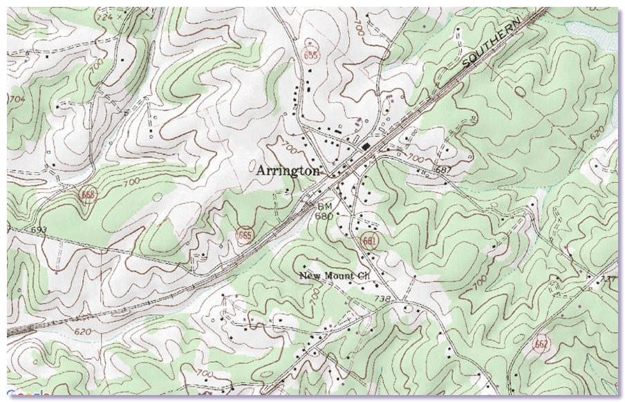
USGS Arrington quad
An inquiry to the Nelson County Historical Society asking whether there had actually been a narrow gauge soapstone railroad found its way to an attorney named Dick Whitehead who sent me copies of ancient DGMR reports on Phoenix Stone Company.
DGMR ECON FILE - STANDARD SOAPSTONE CORP ca1926
The Phoenix Stone report mentioned that the narrow gauge ran to Arrington. So I collected my maps, gassed up the truck and headed out to Arrington and again came up empty. I saw nothing there to suggest an abandoned railroad grade or transfer point.
USGS Arrington quad