April 2023
Narrow or not?
25/04/23 21:04 Filed in: Nelson County | Soapstone in Virginia
The beginning of this saga can be found here.

USGS Buckingham , 1968. Utility map "narrow gauge track" shown in red
The utility company map did not indicate that the narrow gauge railroad went to a connection with the Southern at Arrington, but to a connection with the Chesapeake & Ohio at Norwood.

Tye River and town of Norwood
Norwood is a very small, very old town at the confluence of the Tye and James Rivers.
Concrete abutments along abandoned railroad grade near Norwood
Driving north along the Tye River from Norwood I couldn't miss the substantial remains of an old railroad grade.

Abandoned grade through the woods along Rucker Run
Thanks to local hunters that kept the grade clear, it was relatively easy to follow. Hiking over high fills and through deep cuts, I began to have doubts.

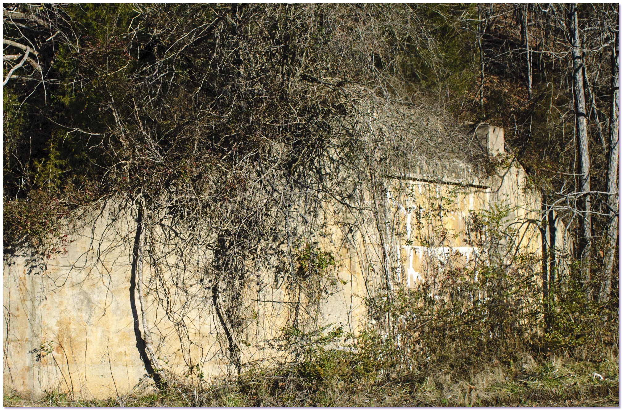
Abandoned soapstone railroad bridge abutment
The extensive grading and heavy concrete abutments impressed me as being too monumental to have been built for the sake of an industrial narrow gauge. This grade looked standard gauge to me.
USGS Buckingham , 1968. Utility map "narrow gauge track" shown in red
The utility company map did not indicate that the narrow gauge railroad went to a connection with the Southern at Arrington, but to a connection with the Chesapeake & Ohio at Norwood.
Tye River and town of Norwood
Norwood is a very small, very old town at the confluence of the Tye and James Rivers.
Concrete abutments along abandoned railroad grade near Norwood
Driving north along the Tye River from Norwood I couldn't miss the substantial remains of an old railroad grade.
Abandoned grade through the woods along Rucker Run
Thanks to local hunters that kept the grade clear, it was relatively easy to follow. Hiking over high fills and through deep cuts, I began to have doubts.
Abandoned soapstone railroad bridge abutment
The extensive grading and heavy concrete abutments impressed me as being too monumental to have been built for the sake of an industrial narrow gauge. This grade looked standard gauge to me.